
Mountain hiking South America routes can take you past granite peaks, volcanic craters, glacial lakes, cloud forests, and remote Andean villages. You can choose an easy half-day walk, a hard mountain day, or a camping route that lasts more than a week.
Planning can feel confusing because every region has different weather, trail rules, transport, and altitude. A trail may look short on a map and still feel hard at 4,500 metres. Some parks allow independent hiking, while others require a registered guide or advance campsite booking.
While comparing routes across the continent, I found that the best choice depends on 4 things: your fitness, altitude experience, available days, and budget. This guide compares the top mountain hikes in South America so you can choose a route that fits your trip.
Quick takeaways
- Best first mountain hike: Cocora Valley, Colombia
- Best one-day challenge: Laguna de los Tres, Argentina
- Best high-altitude day trip: Rainbow Mountain, Peru
- Best village-to-village route: Quilotoa Loop, Ecuador
- Best famous multi-day route: W Trek, Chile
- Best remote circuit: Cordillera Huayhuash, Peru
- Best quieter Patagonia trek: Cerro Castillo, Chile
- Best guided Colombian route: El Cocuy National Park
- Best months for the central Andes: May to September
- Best months for Patagonia: November to March
Best mountain hikes in South America at a glance
| Mountain hike | Country | Usual length | Highest point | Difficulty | Best months |
|---|---|---|---|---|---|
| Laguna de los Tres | Argentina | 1 day | Around 1,170 m | Hard | November to March |
| W Trek | Chile | 4–5 days | Around 1,200 m | Hard | November to March |
| Cerro Castillo Circuit | Chile | 3–4 days | Around 1,700 m | Hard | December to March |
| Cordillera Huayhuash | Peru | 8–12 days | Above 5,000 m | Very hard | May to September |
| Salkantay Trek | Peru | 4–5 days | Around 4,630 m | Hard | May to September |
| Rainbow Mountain | Peru | 1 day | Around 5,036 m | Moderate trail, hard altitude | May to September |
| Quilotoa Loop | Ecuador | 3 days | Around 3,900 m | Moderate to hard | June to September |
| El Cocuy | Colombia | 1 day per trail | Above 4,500 m | Hard | December to March |
| Cocora Valley | Colombia | 4–7 hours | Around 2,860 m | Moderate | December to March |
| Condoriri Trek | Bolivia | 2–3 days | Near 5,000 m | Hard | May to September |
| Aconcagua to Confluencia | Argentina | 1–2 days | Around 3,400 m | Moderate | December to February |
| Vale do Pati | Brazil | 3–5 days | Lower altitude | Moderate to hard | May to September |
Distances, access rules, and costs can change by route version. Check the park and local weather shortly before leaving.
Is South America good for mountain hiking?
South America has some of the best hiking areas for travelers who want varied terrain. The Andes run along the western side of the continent, passing through Colombia, Ecuador, Peru, Bolivia, Chile, and Argentina.
Each country gives you a different type of mountain trip. Patagonia has sharp granite peaks and strong wind. Peru and Bolivia have high passes, dry-season skies, and thin air. Ecuador has volcanic valleys and village routes. Colombia mixes high páramo with green cloud forest.
You also get a wide price range. A self-guided day hike may cost less than $30 once you reach the base town. A guided camping circuit with transport, meals, animals, and staff can cost more than $1,000.
1. Laguna de los Tres and Fitz Roy, Argentina

Best for: A famous Patagonia day hike
Base: El Chaltén
Time: 8–10 hours
Distance: About 20–25 km return
Difficulty: Hard
Budget level: Medium
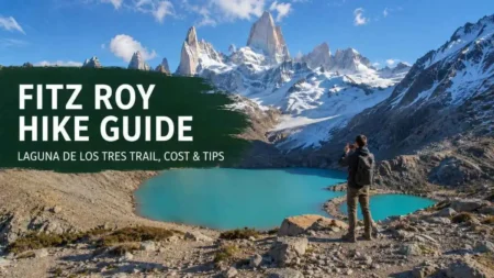
Laguna de los Tres is one of the best-known mountain hikes in South America. The trail begins near El Chaltén and runs through forest, river areas, open ground, and mountain viewpoints before reaching the lagoon below Mount Fitz Roy.
The first part has steady climbing. The final section is much steeper, gaining around 400 metres in a little over 1 hour. Loose stones, wind, and tired legs make the descent slow for many hikers.
The full day usually takes 8 to 10 hours. Leave near first light, carry a waterproof jacket, and save food for the walk back. Cloud can cover Fitz Roy within minutes, even when the morning starts clear.
The town has several other walking routes. My complete guide to the best El Chaltén hikes can help you build a 2-day or 3-day plan.
For distances, trail sections, costs, and packing advice, read the full Fitz Roy hike guide.
Choose this hike when
- You can walk for a full day
- You are comfortable on steep rocky ground
- You have 2 possible hiking days for weather changes
- You want a major Patagonia view without camping
Laguna Capri is a shorter choice for travelers who cannot complete the full route. It gives you forest and mountain views without the steep final climb.
2. W Trek, Torres del Paine, Chile

Best for: A first multi-day Patagonia trek
Base: Puerto Natales
Time: 4–5 days
Distance: Roughly 70–80 km
Difficulty: Hard
Budget level: High
The W Trek passes several of Torres del Paine’s best-known areas. Most routes include Base Torres, Los Cuernos, French Valley, Lake Pehoé, and Glacier Grey.
The trail is marked and has campsites and refugios along the route. Beds, tent spaces, and meal packages sell out early during the main season. Reserve each night before entering the park.
You do not need to carry full camping gear when you book refugio beds and meals. This makes the route easier on your back, though the total price rises fast. Budget hikers can use campsites, prepare simple food, and rent some gear in Puerto Natales.
Patagonia’s wind has a major effect on this trek. Rain may arrive quickly, and exposed sections can feel cold in summer. Carry waterproof outer clothing and keep dry layers inside waterproof bags.
A normal 5-day direction
Day 1: Enter the park and walk near the Central or Las Torres area
Day 2: Hike to Base Torres
Day 3: Continue toward Los Cuernos or Francés
Day 4: Walk into French Valley
Day 5: Continue toward Grey Glacier and leave the park
Some travelers walk the route in the opposite direction. Boat schedules, accommodation, and transport from Puerto Natales may decide which plan works better.
3. Cerro Castillo Circuit, Chile
Best for: Experienced hikers seeking a quieter Patagonia route
Base: Villa Cerro Castillo or Coyhaique
Time: 3–4 days
Distance: About 45–55 km
Difficulty: Hard
Budget level: Medium
Cerro Castillo sits along Chile’s Carretera Austral. The route crosses forest, open valleys, rocky slopes, exposed passes, and glacial water below the mountain’s dark rock walls.
The circuit has fewer services than the W Trek. You need camping equipment, food, a water treatment method, and enough mountain experience to make safe choices in poor weather.
River levels, snow, and trail access can affect the route. Some crossings become harder after heavy rain or warm weather. Ask locally about current trail conditions before setting out.
The main season runs from December to March. January and February bring longer daylight and more hikers. December and March may feel quieter, with a higher chance of cold or unstable weather.
Cerro Castillo suits hikers who have already completed at least one unsupported overnight trek. A guided trip is a sensible choice when you have limited camping experience.
4. Cordillera Huayhuash Circuit, Peru

Best for: Experienced high-altitude trekkers
Base: Huaraz or Chiquián
Time: 8–12 days
Distance: Around 110–130 km
Difficulty: Very hard
Budget level: Medium to high
The Cordillera Huayhuash circuit passes glacial lakes, high mountain camps, rural communities, and several passes above 4,500 metres. Some route versions cross points close to or above 5,000 metres.
Most camps sit above 4,000 metres. Cold nights, long climbs, changing weather, and limited road access make this a serious route. Proper acclimatization in Huaraz should be part of your plan.
Guided groups often use donkeys or mules to carry tents, food, and larger bags. You walk with a smaller daypack. Independent trekking is possible for skilled hikers, though route finding, community fees, transport, and emergency planning need care.
A sensible preparation plan
Spend at least 3 days in Huaraz before starting. Use those days for short walks and one higher day hike. Take a rest day when headaches, nausea, or poor sleep continue.
A normal daily stage can last 5 to 8 hours. Some days include a long pass followed by a steep descent to camp. Cold evenings begin soon after sunset, so you need a warm sleeping bag and insulated mat.
Huayhuash is a poor choice for a first high-altitude trek. Build experience on a 2-day or 3-day route before booking the full circuit.
5. Salkantay Trek, Peru

Best for: Reaching the Machu Picchu area on foot
Base: Cusco
Time: 4–5 days
Distance: Around 60–80 km, based on route
Highest point: Around 4,630 m
Difficulty: Hard
Budget level: Medium
The Salkantay Trek crosses a high mountain pass before dropping into warmer forest and valley areas. Most guided routes finish near Aguas Calientes, followed by a Machu Picchu visit.
The hardest stage reaches Salkantay Pass. The climb starts cold and early. Thin air slows your pace, and the long descent can be tiring on the knees.
Spend 2 or 3 days in Cusco or the Sacred Valley before leaving. Travelers arriving directly from Lima may struggle with the sudden rise in altitude.
Tours vary in price and comfort. Budget trips often use basic camps, larger groups, and simple meals. Higher-priced trips may use smaller groups, better sleeping setups, stronger guide support, and upgraded accommodation.
Check whether your price includes:
- Cusco pickup
- Meals during the trek
- Camping equipment
- Bag transport
- Machu Picchu ticket
- Aguas Calientes hotel
- Train or bus transport back to Cusco
- Entrance and community charges
Travelers still choosing their month can compare dry and wet periods in the best time to visit Peru guide.
6. Rainbow Mountain, Peru

Best for: A high-altitude day trip from Cusco
Time: Full day from Cusco
Walking time: Usually 2–4 hours
Highest point: Around 5,036 m
Difficulty: Moderate trail, hard altitude
Budget level: Low to medium
Rainbow Mountain is shorter than the major multi-day Peru treks. Its altitude makes the walking feel much harder than the distance suggests.
Most group tours leave Cusco before sunrise. The day includes a long drive, breakfast, the mountain walk, lunch, and a return to Cusco in the afternoon.
Spend at least 2 days at altitude before going. A traveler who feels sick in Cusco should delay the tour. Horses may reduce some walking, though they do not remove the effect of thin air.
Cold wind, mud, snow, and cloud may affect the route. May to September usually gives you a better chance of dry ground and clear views. June to August is busier.
The Rainbow Mountain Peru guide covers current costs, tour choices, Red Valley, altitude, and the easier Palccoyo option.
7. Quilotoa Loop, Ecuador

Best for: Village stays and lighter multi-day hiking
Base: Latacunga
Time: 3 days
Distance: Around 34–40 km
Difficulty: Moderate to hard
Budget level: Low
The Quilotoa Loop passes rural villages, farms, steep valleys, river crossings, and a volcanic crater lake. Most travelers walk between Sigchos, Isinliví, Chugchilán, and Quilotoa.
Guesthouses make this route easier than a camping trek. Many stays include dinner and breakfast, so you can walk with a light backpack.
The trail has steep climbs and descents. Signs can be unclear at some junctions, and rain can turn the ground muddy. Download an offline map before leaving Latacunga.
The final climb to Quilotoa crater is the hardest part for many hikers. Starting from Chugchilán gives you a long uphill day before reaching the crater rim.
This route works well for travelers who want a multi-day mountain walk without carrying a tent or cooking equipment. The full Quilotoa Loop guide includes the route order, buses, hostel planning, daily costs, and a 3-day plan.
8. El Cocuy National Park, Colombia

Best for: High páramo and glacier views
Base: El Cocuy or Güicán
Time: Separate full-day trails
Highest walking areas: Above 4,500 m
Difficulty: Hard
Budget level: Medium
El Cocuy National Park has high Andean terrain, glacial lakes, páramo plants, and views of shrinking snow-covered peaks.
Visitors normally complete approved day routes rather than one open multi-day circuit. Registration, insurance, local transport, and a registered guide may be required. Trail access can change because of weather, conservation work, or agreements with local communities.
Walking onto glaciers, crossing closed areas, and climbing peaks may be prohibited. Follow the current park route and your guide’s instructions.
Reach the region at least 1 day before your first hike. The road trip from Bogotá is long, and the high trailheads need acclimatization. A second rest day is useful when you arrive from a low city.
Carry warm clothing, sun protection, water, food, and cash. Mobile service can be weak once you leave the towns.
Before planning a longer Colombia trip, check the latest Colombia visa requirements.
9. Cocora Valley, Colombia

Best for: First-time hikers and shorter trips
Base: Salento
Time: 4–7 hours
Distance: Around 10–14 km for the full loop
Difficulty: Moderate
Budget level: Low
Cocora Valley is known for wax palms, steep green slopes, cloud forest, farms, and mountain views. It is one of the easiest routes on this list to add to a normal Colombia itinerary.
The full loop can be wet and muddy. Some sections use narrow paths, bridges, and steady uphill walking. The shorter palm viewpoint route suits families, casual walkers, and travelers with limited time.
Start early to avoid the largest day-trip crowds. Morning weather is often clearer, and afternoon rain is common in the region.
Wear footwear with grip. Rain boots can be rented near the entrance during wet periods, though proper hiking shoes give better ankle support on the full loop.
The Cocora Valley Colombia guide compares the full loop, short route, costs, transport from Salento, and common trail mistakes.
10. Condoriri Trek, Bolivia
Best for: A short high-altitude camping trip
Base: La Paz
Time: 2–3 days
Highest points: Close to 5,000 m
Difficulty: Hard
Budget level: Medium
The Condoriri area sits within reach of La Paz and gives hikers access to high valleys, lakes, mountain passes, and snow-covered peaks.
This route is shorter than Huayhuash, though the altitude is still serious. Several nights in La Paz or a lower-altitude hiking plan should come first.
Most visitors use a local guide and arranged transport. A guide can handle camps, meals, route choice, and changing weather. Snow may cover higher sections during some periods.
Cold nights are normal during the dry season. Bring a sleeping bag rated for below-freezing temperatures, warm gloves, a hat, and dry socks.
Condoriri is a good step between day hiking and a long Peru circuit. It still needs strong fitness, careful pacing, and clear insurance coverage for trekking near 5,000 metres.
11. Aconcagua hike to Confluencia, Argentina
Best for: Seeing the Aconcagua area without climbing the summit
Base: Mendoza
Time: 1 long day or 2 days
Highest point: Around 3,400 m at Confluencia
Difficulty: Moderate
Budget level: Medium to high
Aconcagua is the highest mountain outside Asia. Reaching its summit is a mountaineering expedition. Regular hikers can visit the national park and walk part of the approach route.
Confluencia is a common goal. The route passes dry mountain ground with wide views of the surrounding Andes. Sun, wind, and dry air can make the day tiring.
Park permits and access rules depend on the activity and season. Check the current rate before travelling from Mendoza. Carry your passport and any required documents.
A 2-day trip gives you a calmer pace and more time in the park. A same-day plan may involve early transport and a firm return time.
Use a guide when you have no high-altitude experience or do not have private transport. Guided trips may include permits, pickup, food, and park support.
After hiking in Argentina, many travelers continue north using an Iguazu Falls travel plan as a warmer break from mountain weather.
12. Vale do Pati, Chapada Diamantina, Brazil
Best for: Mountain valleys and local homestays
Base: Lençóis, Andaraí, or Guiné
Time: 3–5 days
Difficulty: Moderate to hard
Budget level: Medium
Vale do Pati gives hikers a different side of mountain hiking in South America. The area has table-top mountains, deep valleys, waterfalls, rocky paths, forest, and small local communities.
Many routes use family homestays rather than campsites. Meals may be included, which reduces the amount of food and gear you carry.
Heat and humidity can affect walking, even though the altitude is much lower than Peru or Bolivia. Start early, drink often, and keep sun protection close.
The drier months from May to September are usually easier for long walking days. Waterfall levels may drop after long dry periods, so the best month depends on whether you care more about stable trails or stronger water flow.
A local guide is useful because several route versions cross remote ground with few signs. Your starting and finishing villages may also differ.
Which South America mountain hike fits you?
| Traveler type | Best choice | Main reason |
|---|---|---|
| Beginner | Cocora Valley | Short routes and easy access |
| First multi-day hiker | Quilotoa Loop | Guesthouses remove camping needs |
| Strong day hiker | Laguna de los Tres | Long day with a clear base town |
| First Patagonia trek | W Trek | Managed camps and marked paths |
| Experienced camper | Cerro Castillo | Remote route with fewer services |
| Experienced altitude trekker | Huayhuash | Long passes and high camps |
| Machu Picchu planner | Salkantay | Mountain route ending near the site |
| Short Cusco trip | Rainbow Mountain | One full-day tour |
| Colombia mountain trip | El Cocuy | Approved guided high routes |
| Bolivia add-on | Condoriri | Short camping plan near La Paz |
| Non-camping trek | Vale do Pati | Homestays and meals |
| Easier high mountain visit | Aconcagua to Confluencia | Partial approach without summit climbing |
How much does mountain hiking in South America cost?
Costs depend on the country, guide rules, park entry, accommodation, transport, and equipment.
Rough planning ranges
| Hiking style | Rough cost per person |
|---|---|
| Self-guided local day hike | $15–$80 |
| Guided day trip | $40–$180 |
| 3-day guesthouse trek | $100–$300 |
| 3-day camping trek | $180–$500 |
| 4–5 day guided route | $250–$900 |
| Long supported circuit | $600–$1,800+ |
| Patagonia refugio trek | $500–$1,300+ |
These ranges exclude international flights and major personal gear purchases.
Patagonia tends to cost more because transport, accommodation, food, and park services are expensive. Ecuador and Colombia usually give budget travelers more low-cost choices. Peru and Bolivia can be affordable, though guide support and animal transport raise the price of long routes.
Costs travelers forget
- Park entry
- Community access payments
- Trailhead transport
- Luggage storage
- Camping reservations
- Sleeping bag rental
- Trekking pole rental
- Drinking water or purification tablets
- Toilets and showers
- Tips for guides, cooks, and animal handlers
- Emergency transport
- Insurance covering the route’s altitude
Keep extra cash in the local currency. Small communities and trail entrances may have no card payment or reliable internet.
Best time for mountain hiking in South America
South America has no single hiking season. The best month changes by region.
Patagonia
Main period: November to March
December, January, and February give longer days and more open services. They also bring higher prices and larger crowds.
October, November, March, and April can be quieter. Cold fronts, snow, and reduced transport are more likely near the edges of the season.
Peru and Bolivia
Main dry period: May to September
Dry-season months give clearer mountain views and firmer trails. Nights can fall below freezing at high camps.
April and October can work for flexible hikers. January and February bring heavier rain in many Andean areas.
Ecuador
Common hiking periods: June to September and parts of December to February
Ecuador’s weather changes by valley, altitude, and side of the Andes. Rain can occur during any month.
Quilotoa hikers should pack for sun, cold wind, and rain during the same day.
Colombia
Common drier periods: December to March and July to August
Cocora Valley stays green because rain is common throughout the year. El Cocuy has stricter seasonal and access limits, so check the park before fixing your travel dates.
Brazil
Common period for Chapada Diamantina: May to September
The drier period usually gives more stable walking conditions. Hot days still require an early start and plenty of water.
How to prepare for high altitude
Several mountain hiking South America routes rise above 4,000 metres. Fitness does not protect a person from altitude illness.
Give your body time before hard exercise. Spend 2 or 3 nights at a higher city or valley before hiking above 4,500 metres. Cusco, Huaraz, La Paz, and the Lake Titicaca area are common acclimatization bases.
A calm day around Puno can fit before some southern Peru routes. Use this Lake Titicaca travel guide to plan transport, islands, costs, and lighter activities.
Common mild symptoms
- Headache
- Poor sleep
- Reduced appetite
- Dizziness
- Nausea
- Unusual tiredness
- Shortness of breath during light walking
Stop climbing when symptoms become stronger. Descend and seek medical care for confusion, loss of balance, breathing trouble at rest, or a severe headache that continues.
Speak with a doctor before the trip when you have heart, lung, blood pressure, or other medical conditions. Ask before taking altitude medication.
How fit do you need to be?
You do not need to be an athlete for every route. Your preparation should match the distance, elevation gain, pack weight, and number of days.
For a moderate day hike
Build up to walking 10–15 km. Add hills or stairs once or twice each week.
For a hard day hike
Practice 15–20 km days with 600–1,000 metres of climbing. Carry the same backpack weight you plan to use.
For a guesthouse trek
Complete 2 long walks on back-to-back days. Your body needs to handle effort while your legs are still tired.
For a camping circuit
Train with a loaded backpack. Include long climbs, uneven ground, and several walking days in one week.
Start training 6–10 weeks before a major trip. Increase distance slowly so your knees, feet, and ankles can adjust.
Mountain hiking packing list
Your final packing list depends on season, altitude, and whether you are camping.
Clothing
- Waterproof jacket with hood
- Warm fleece or insulated layer
- Quick-dry base shirts
- Hiking trousers
- Thermal top and bottom for high camps
- Warm hat and gloves
- Sun hat
- Spare hiking socks
- Dry clothing for camp
Walking gear
- Hiking shoes or boots with good grip
- Trekking poles
- 20–30 litre daypack
- Larger backpack for unsupported routes
- Headlamp with spare batteries
- Offline trail map
- Portable charger
- Water filter or purification tablets
Health and safety items
- Personal medicine
- Small first-aid kit
- Blister treatment
- Sunscreen
- Sunglasses
- Emergency blanket
- Whistle
- Toilet paper
- Hand sanitizer
- Insect repellent for lower warm areas
Avoid carrying heavy items you will not use. Each extra kilogram becomes harder during long climbs and high-altitude days.
Can you hike alone?
Solo hiking is common on busy routes near El Chaltén, Salento, and Quilotoa. Remote circuits need stronger skills and a better emergency plan.
Choose a guide when:
- Park rules require one
- Snow covers the route
- The trail has difficult river crossings
- You are camping for the first time
- You have little altitude experience
- You do not speak enough Spanish for local transport
- Phone service is limited
- You are travelling outside the main season
Tell your accommodation where you are going and your expected return time. Share your route with someone who is not on the hike.
A busy trail can still become quiet late in the day. Carry a headlamp, food, warm clothing, and a map even on a popular day route.
Mountain safety rules
Check the weather on the morning of your hike. Ask local guides or park staff about snow, river levels, strong wind, fire closures, and damaged paths.
Set a turn-around time before leaving. Use it even when the viewpoint is close. A late descent brings lower temperatures, reduced visibility, and tired legs.
Stay on approved trails. Short side paths may damage fragile plants or lead onto unstable ground.
Keep food for the return. Many hikers eat most of their snacks at the viewpoint and have little energy left for the descent.
Treat stream water before drinking unless the park confirms a safe source. Animals and camps can contaminate water that looks clear.
Keep your passport, phone, money, and dry layer inside a waterproof bag.
Travel insurance for mountain hiking
Read the policy activity limits before paying. Some plans cover normal walking and exclude trekking above a set altitude.
Check these points:
- Maximum hiking altitude
- Guided and independent trekking rules
- Emergency medical treatment
- Search and rescue
- Helicopter evacuation
- Multi-day camping
- Existing medical conditions
- Country or regional exclusions
Save the policy number and emergency contact offline. Give a copy to a travel partner or family member.
Three simple mountain hiking routes
2-week Patagonia plan
Days 1–3: Arrive in El Calafate and continue to El Chaltén
Days 4–6: Use 2 hiking days and 1 weather backup day
Day 7: Travel to Puerto Natales
Days 8–12: Complete the W Trek
Days 13–14: Return to Puerto Natales or Punta Arenas
Keep 1 flexible day between major hikes. Weather and transport delays are common.
2-week Peru hiking plan
Days 1–3: Cusco and the Sacred Valley
Day 4: Rest or complete a light walk
Days 5–9: Salkantay Trek
Day 10: Rest in Cusco
Day 11: Travel or rest
Day 12: Rainbow Mountain when you feel well
Days 13–14: Extra Cusco time or departure
Check the Peru visa requirements before booking flights and permits.
10-day beginner plan in Ecuador and Colombia
Days 1–2: Quito and altitude adjustment
Days 3–5: Quilotoa Loop
Day 6: Return to Quito
Day 7: Fly to Colombia
Days 8–9: Salento
Day 10: Cocora Valley short route or full loop
This plan uses guesthouses and city accommodation, so you do not need camping gear.
Common planning mistakes
Choosing by photos alone
Check walking time, elevation gain, altitude, pack weight, and trail surface before booking.
Planning a hard hike after a flight
Long travel reduces sleep and hydration. Keep your arrival day easy.
Skipping acclimatization
A short high route can feel harder than a long low route. Give high-altitude days proper space.
Booking every day
Weather may remove your first hiking chance. Add at least 1 spare day in Patagonia and high mountain regions.
Buying new shoes before departure
Walk in your shoes for several weeks. New footwear can cause blisters within the first few hours.
Carrying too little food
Pack lunch and several small snacks. Keep one snack untouched for the final part of the route.
Depending on phone service
Download maps, tickets, accommodation details, and transport times before leaving town.
Ignoring return transport
Ask when the final bus, shared taxi, boat, or park transfer leaves. Missing it can lead to an expensive private ride.
Final thoughts
Mountain hiking South America trips work for many skill levels. Cocora Valley and the Quilotoa Loop suit newer hikers. Fitz Roy and the W Trek need stronger fitness. Huayhuash, Condoriri, and remote Patagonia circuits need altitude preparation and camping experience.
Choose one major hike for each part of your trip, add rest days, and keep space for weather changes. A slower plan gives you more time to enjoy the mountains and lowers the chance of illness, injury, or missed transport.
Research check kept outside the publishable copy: W Trek accommodation needs advance booking, Huayhuash routes commonly take 10–14 days, Salkantay routes reach about 4,600 metres, and El Cocuy has controlled trails with guide and access rules.