


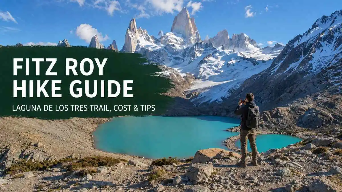
The Fitz Roy hike is one of the best-known day hikes in Patagonia. Planning it can still feel confusing because distance figures vary, the weather changes fast, and the final climb to Laguna de los Tres is much harder than the earlier trail.
Most hikers start in El Chaltén and spend a full day walking to Laguna de los Tres. Plan for 8 to 10 hours, about 20 to 25 km round trip, and 750 m of total elevation gain. The official 2026 tourism map lists 10 km and about 4 hours each way, while a local trail guide lists 25 km for the full route. Your final distance depends on your starting point, side stops, and GPS tracking.
When I planned this route, the mixed distance figures were the first problem. The simplest way to prepare is to treat it as a long mountain day, leave early, carry proper rain gear, and save energy for the steep final hour.
Quick answer: The classic Fitz Roy hike goes from El Chaltén to Laguna de los Tres. It is a hard, non-technical day hike in dry summer conditions. The final section climbs about 400 m in a little over 1 hour. Start near first light, allow 8 to 10 hours, and buy your park ticket online before reaching the trailhead.
Fitz Roy hike at a glance
| Detail | Planning figure |
|---|---|
| Main destination | Laguna de los Tres |
| Starting town | El Chaltén, Argentina |
| Route type | Out and back |
| Distance | About 20 to 25 km round trip |
| Walking time | 8 to 10 hours |
| Elevation gain | About 750 m |
| Difficulty | Hard |
| Trail marking | Clear in the main season |
| Guide needed | Usually optional in dry conditions |
| Park fee | ARS 50,000 general entry from 1 June 2026 |
| Best period | Late November to early March |
| Main challenge | Final 400 m climb to the lagoon |
Where is the Fitz Roy hike?
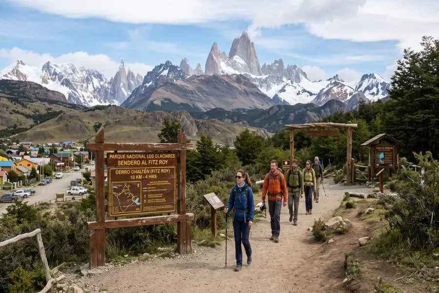
Mount Fitz Roy sits near El Chaltén in the northern part of Los Glaciares National Park, Santa Cruz Province, Argentina. El Chaltén is the base town for the trail, and several routes begin within walking distance of its small centre.
Los Glaciares National Park covers more than 726,000 hectares and has protected Patagonian forest, steppe, glaciers, lakes, and granite peaks. The park became a UNESCO World Heritage Site in 1981.
Many travelers use the name Fitz Roy hike for several walks around the mountain. The main route is the Laguna de los Tres hike because it reaches the closest public viewpoint below Fitz Roy. Shorter choices include Laguna Capri and the Fitz Roy viewpoint.
Which Fitz Roy trail should you choose?

Laguna de los Tres
Choose Laguna de los Tres when you have a full day, good weather, and enough fitness for a long final climb. This is the classic route covered in this guide.
Laguna Capri
Laguna Capri is a better fit for a shorter day. The official map lists 4 km and about 1 hour 45 minutes each way, with around 350 m of elevation gain. Many hikers finish the round trip in 4 to 5 hours, including time beside the lake.
Fitz Roy viewpoint
The Fitz Roy viewpoint sits along the main trail before Poincenot Camp. It gives a clear mountain view without the final ascent to Laguna de los Tres. This choice works well when the upper trail has ice, strong wind, or thick cloud.
Laguna de los Tres from El Pilar
A transfer can take you north of town to the El Pilar trailhead. From there, the route passes forest and the Piedras Blancas area before joining the main trail near Poincenot. You then climb to Laguna de los Tres and return to El Chaltén.
This route cuts down repeated walking and gives you more varied scenery. You need to arrange a morning transfer in town. El Pilar sits about 13 km from El Chaltén and is a known starting point for Poincenot and Laguna de los Tres. If you are comparing mountain hikes across South America, my Cocora Valley Colombia Guide covers a shorter route with full-loop and short-walk options.
Fitz Roy hike route, section by section

1. El Chaltén to the De las Vueltas viewpoint
The main trail begins at the end of Avenida San Martín, where the town meets the park. The access point is called the Base Fitz Roy Portal.
The first hour climbs through open ground and low forest. This early slope can feel tiring when you start too fast. Set an easy pace and let your legs warm up.
A viewpoint over the De las Vueltas River valley appears during this section. It is a good place for a quick stop, especially when the sky is clear.
2. De las Vueltas viewpoint to the Fitz Roy viewpoint
The trail enters thicker forest and follows the Del Salto stream valley. Around 1 hour 30 minutes from town, you reach a signed rocky viewpoint facing Fitz Roy and nearby granite peaks.
This view can be excellent even when the lagoon area later becomes cloudy. Take a few photos, then continue before the trail gets busier.
3. Laguna Capri junction and Poincenot Camp
The path continues through lenga and ñire forest. A signed junction leads to Laguna Capri, which adds a pleasant lakeside stop. You can also save it for the return walk if daylight and energy allow.
Poincenot Camp is around 8 km from El Chaltén on the official map. The one-way time is about 2 hours 45 minutes for a steady hiker, though stops often push this closer to 3 hours.
The ground around Poincenot is flatter and more sheltered. This is a smart place to eat part of your lunch before the hardest section.
4. Río Blanco and the final climb

After Poincenot, the trail crosses the Río Blanco area. The final ascent begins soon after the crossing.
This section gains about 400 m in a little over 1 hour. The path is steep, rocky, and exposed. Crowds can slow both the climb and descent, especially from late morning onward.
Use short steps. Stop where other hikers can pass safely. Trekking poles are useful on the descent because loose stones and tired legs make slips more likely.
5. Laguna de los Tres and Laguna Sucia viewpoint

The climb ends on an old moraine ridge above Laguna de los Tres. Fitz Roy rises directly behind the glacial water, with the De los Tres glacier below the rock walls.
Walk a little to find a safe place away from the main crowd. Wind can be much stronger here than in the forest, so add a warm layer before sitting down.
A short path near the lagoon leads to a view over Laguna Sucia. Add this side stop when the ground is dry, visibility is good, and you still have enough time for the descent. The edge is exposed, so keep back from loose slopes.
How hard is the Fitz Roy hike?
The full Laguna de los Tres route is hard for most casual hikers. The early and middle sections are steady, and the last climb raises the effort sharply.
The main physical demands are the long distance, strong wind, rough ground, and final 400 m ascent. A person who regularly walks 15 to 20 km and can climb stairs for 45 to 60 minutes has a fair base for the route.
Do 2 or 3 longer walks before your trip. Add hills, carry a light daypack, and practice eating while moving. This preparation also reduces soreness during the descent.
For a shorter hike at much higher altitude, compare the route with my Rainbow Mountain Peru guide. Fitz Roy stays lower, though the day is longer and the weather can be harsher.
Best time to hike Fitz Roy
Late November through early March gives most travelers the best mix of daylight, transport, open accommodation, and trail access. January to March is the busiest period, while basic tourism services usually run from October through April.
El Chaltén can have sun, rain, strong wind, and snow on the same day. Summer temperatures are mild, and the wind is common from October through March. Warm and waterproof layers belong in your pack even when the morning looks clear.
| Period | Conditions | Crowds | Best for |
|---|---|---|---|
| October to November | Long days, cool weather, possible snow and mud | Low to medium | Flexible travelers |
| December to February | Longest daylight, most services, frequent wind | High | First visits and day hikes |
| March | Cooler days, changing colors, shorter daylight | Medium to high | Photography and fewer tour groups |
| April | Cold mornings, shorter days, higher snow risk | Low | Experienced hikers with flexible plans |
| May to September | Winter snow, ice, short days, limited services | Very low | Guided winter trips |
From April to October, snow on the upper trail can block or slow access, especially during the final climb. Check the park update and local forecast before leaving town.
Fitz Roy park entrance fee in 2026
Los Glaciares National Park charges for the northern trail portals around El Chaltén. The following prices took effect on 1 June 2026:
| Visitor category | Entry fee |
|---|---|
| General visitor | ARS 50,000 |
| Argentine resident | ARS 25,000 |
| Santa Cruz provincial resident | ARS 8,000 |
| Student | ARS 15,000 |
| General 3-day Flexipass | ARS 100,000 |
Tickets for the northern zone portals are sold online. At the portal, payment is by credit or debit card through the online system; cash is not accepted. Student and resident rates need valid proof.
Buy the ticket before your hiking morning. Mobile service can be weak, and fixing a payment problem at the trailhead wastes your coolest walking hours.
The entry fee and camping fee are separate. Check both costs when planning a sunrise camp at Poincenot.
Price check: July 2026. Argentina changes peso prices often, so confirm the official amount close to your visit.
A realistic Fitz Roy hiking budget
Your trail day can stay fairly simple once you are sleeping in El Chaltén. The trailhead is within town, so the classic route needs no taxi or tour.
One hiking day from El Chaltén
| Item | Budget plan |
|---|---|
| Park entry | ARS 50,000 general rate |
| Packed lunch and snacks | Buy from a supermarket or bakery the day before |
| Trail transport | ARS 0 from town |
| Optional El Pilar transfer | Ask for the live local rate |
| Gear rental | Depends on poles, rain gear, or winter equipment |
A supermarket lunch keeps costs down. Bread, cheese, fruit, nuts, chocolate, and a filled sandwich are easier to carry than a large prepared meal.
Extra cost from El Calafate
Buses between El Calafate and El Chaltén take about 3 hours. A local transport guide listed ARS 50,000 one way plus an ARS 2,000 El Chaltén terminal fee, while current booking results often sit closer to ARS 40 to 60 equivalent. Book early in the busy season and check the final peso amount before paying.
Dorm beds often start near USD 20 and can rise above USD 40 during busy dates. Private budget rooms commonly cost much more, so solo travelers save the most by booking a dorm or campsite early.
A low-cost 2-night plan usually includes:
- Return bus from El Calafate
- 2 hostel nights
- 1 park entry for the Fitz Roy day
- Supermarket breakfast and trail lunch
- 1 or 2 simple dinners in town
Keep prices in their original currency until you book. Exchange rates can make an old dollar conversion misleading.
How to get to El Chaltén
From El Calafate
El Calafate is the main gateway. Most travelers fly into Comandante Armando Tola International Airport, continue to El Calafate town, and take a bus to El Chaltén.
The road trip is about 215 km and usually takes close to 3 hours. Several companies run buses during the main season. Some airport transfers also go directly to El Chaltén, which can save a night in El Calafate.
From Puerto Natales
Travel from Puerto Natales requires a connection through El Calafate on current bus routes. Border checks and limited schedules can turn this into a long day, so avoid placing a Fitz Roy hike early the next morning.
By rental car
A car gives you more freedom for El Pilar, Lago del Desierto, and weather changes. The classic Laguna de los Tres trail starts in town, so the car adds little value on the main hiking day.
Where to stay for the Fitz Roy hike
El Chaltén is small. Most central stays put you within a short walk of the main trailhead.
Stay near the north end of Avenida San Martín for the shortest walk to the Base Fitz Roy Portal. Stay closer to the bus terminal when you have an early departure or heavy luggage.
A hostel or apartment with a kitchen can cut food costs. Budget lodges and hostels are among the lower-cost stays in town. Buy your trail food before evening because some shops close earlier outside summer.
Book January, February, and March dates early. These months bring the largest visitor numbers, and lower-cost beds sell first.
For a longer Argentina trip, pair Patagonia with my Iguazu Falls travel guide and leave at least 1 full travel day between regions.
What to pack for the Fitz Roy hike

Patagonian weather makes clothing choice more serious than the trail’s low starting altitude suggests.
Clothing
- Waterproof rain jacket with a hood
- Warm fleece or light insulated jacket
- Quick-dry shirt
- Hiking trousers or leggings
- Spare dry socks
- Warm hat and gloves
- Sun hat
Hiking gear
- Hiking shoes or boots with good grip
- 20 to 30 litre daypack
- Trekking poles
- Headlamp with charged batteries
- Offline trail map
- Small first-aid kit
- Sunscreen and sunglasses
- Portable charger
- Emergency blanket
The local tourism office tells hikers to carry warm clothing, a raincoat, gloves, a hat, good trekking shoes, enough food, and sun protection. Fires are forbidden, and hikers should stay on marked paths and carry all waste back to town.
A phone torch is a weak backup. Carry a proper headlamp, even on a normal daytime hike, because delays can push the return into darkness. The local trail guide gives the same advice.
Food and water for the trail
Eat breakfast before leaving and start with food already in your body. The first climb feels harder on an empty stomach.
Carry a full lunch plus small snacks you can eat every 60 to 90 minutes. Good choices include sandwiches, bananas, dried fruit, nuts, crackers, chocolate, and an energy bar kept for the descent.
Start with at least 1.5 to 2 litres of water. Streams run through the area, though untreated surface water can carry germs. A small filter or purification tablets give you a safer refill option.
There are no cafés or food stands on the trail. Poincenot has a latrine and very basic camp facilities, with no supplies or electricity.
Toilets and trail facilities
Latrines are available at the managed campsites, including Laguna Capri and Poincenot. The lagoon itself has no proper toilet, shelter, food service, or waste collection.
Use the camp latrines before the final climb. Pack toilet paper and hand sanitizer. Carry every wrapper, tissue, and food scrap back to El Chaltén.
Fires are forbidden. Campers need a gas stove for cooking and must use the approved camping areas.
Hiking Fitz Roy at sunrise

Sunrise can turn the granite peaks orange and red for a few minutes. Reaching Laguna de los Tres at that time takes extra planning.
The safer plan is to reserve Poincenot Camp, sleep there, and begin the final climb before dawn. The campsite is managed, paid, and requires a reservation.
Starting from El Chaltén means walking for around 4 hours in darkness. Leave 4.5 to 5 hours before sunrise, carry a headlamp, hike with a partner, and check the upper trail for snow or ice.
A clear weather window matters more than a fixed date. Thick cloud can hide Fitz Roy, and strong wind makes waiting beside the lagoon uncomfortable.
Can you hike Fitz Roy without a guide?
The classic route is commonly walked without a guide during dry main-season conditions. The trail is signed, and many hikers use it each day.
Hire a registered guide when snow or ice covers the final slope, you have limited mountain experience, you plan a winter hike, or you feel unsure about a pre-dawn start.
A guide can also make sense for a family group or anyone who wants transport from El Pilar arranged as part of the day.
Solo hiking safety
Solo hikers regularly use this route in summer. The busy trail gives some comfort, though you still need a clear safety plan.
Tell your accommodation where you are going and when you expect to return. Download the map, carry a headlamp, and keep enough battery for the full day.
Turn back when the final slope has hard ice, visibility drops, or wind affects your balance. The lagoon will still be there on another day.
Keep a steady descent pace. Many small injuries happen after the main viewpoint when hikers are tired and stop watching loose rocks.
Camping near Fitz Roy
Poincenot is the most useful campsite for a Laguna de los Tres sunrise. Laguna Capri also has a managed campsite, though it sits farther from the final climb.
Park campsites around El Chaltén are now managed and require a reservation. They have latrines and very basic facilities. Bring your own tent, sleeping system, food, and gas stove.
Camping cuts the early-morning distance, though it adds pack weight and a separate fee. Reserve before arriving during the busy season.
For a multi-day route with village stays and a lighter pack, read my Quilotoa Loop guide. The trail setup is different, but the packing and pacing lessons are useful.
Common mistakes on the Fitz Roy hike
Starting too late
A late start means more heat, more crowds on the final climb, and a greater chance of returning after sunset. Begin near first light for a normal day hike.
Trusting the town weather
El Chaltén can look calm while the upper ridge has cloud and strong wind. Check more than one forecast and ask your accommodation about current trail reports.
Wearing smooth trainers
The final climb and descent need grip. Wet rock, mud, and loose stones make worn city shoes a poor choice.
Carrying too little food
A long day needs more than one sandwich. Pack small snacks for the climb and keep something for the last 2 hours back to town.
Spending too long at every stop
Laguna Capri, Fitz Roy viewpoint, Poincenot, and Laguna Sucia can add a lot of time. Decide your turn-around time before leaving.
Following other hikers without checking the path
Crowds can spread onto loose side tracks near the final climb. Stay on the marked route and use your offline map at unclear junctions.
Planning only 1 day in El Chaltén
Cloud can hide Fitz Roy for a full day. A 3-night stay gives you 2 full hiking days and a better chance of using the clearer forecast.
A simple 3-day El Chaltén plan
Day 1: Arrive and prepare
Check into your stay, buy food, confirm your park ticket, and visit the tourism office or park visitor centre. Use the evening for a short local viewpoint if weather and daylight allow.
Day 2: Fitz Roy and Laguna de los Tres
Start early and keep the whole day open. Return to town, eat a proper dinner, and avoid booking a fixed evening activity.
Day 3: Weather backup or Laguna Torre
Use this day for Fitz Roy when Day 2 has poor weather. When the first hike goes ahead, walk to Laguna Torre or choose a shorter recovery trail.
The 3-day general Flexipass costs ARS 100,000, the same as 2 separate general entries. It gives better value when you plan 3 paid trail days.
If your South America trip continues north, my Lake Titicaca travel guide can help with the next part of your route.
Is the Fitz Roy hike worth it?
The Fitz Roy hike earns a full day in El Chaltén when the weather gives you a clear view. The route has forest, river views, glacial water, and one of Patagonia’s most famous mountain scenes.
The final climb asks for patience and enough energy for the long return. Give yourself 2 possible hiking days, start early, and make the safer turn-around choice when conditions change.
Final thoughts
A good Fitz Roy hike guide should prepare you for the final hour, the park fee, and the weather gap between town and the upper trail. Plan for a 20 to 25 km day, carry layers, and keep a second hiking day free.
Laguna de los Tres is a demanding goal, though the route gives good views well before the top. A cloudy or icy upper trail can still leave you with Laguna Capri, the Fitz Roy viewpoint, and a strong day in Los Glaciares National Park.


