

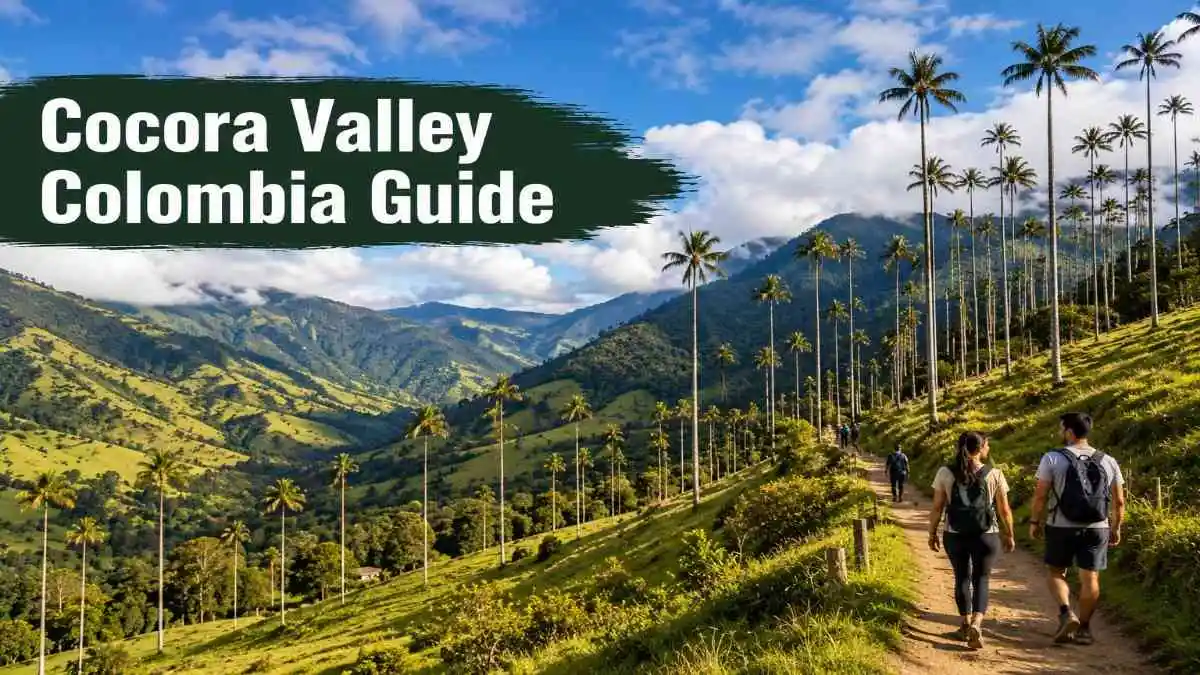
Cocora Valley is known for its tall Quindío wax palms, green mountain slopes, cloud forest, and narrow river bridges. Before my first visit, I had the same questions many travelers have. How hard is the full loop? How much cash should I bring? Is Acaime worth the extra walk? Can I see the palms without hiking for 6 hours?
After walking through the valley, crossing the wooden bridges, and seeing the palms rise above the mist, I understood why Cocora appears on so many Colombia itineraries. I also learned that route direction, recent rain, footwear, and start time can change the whole day.
This Cocora Valley Colombia guide covers the short walk, full hiking loop, 2026 costs, Willys Jeep transport, Acaime detour, weather, trail problems, and the choices that matter once you arrive.
If your Colombia trip begins in the capital, you can use my Bogotá 3 Day Itinerary before traveling to the Coffee Region.
What is Cocora Valley?
Cocora Valley, known locally as Valle de Cocora, lies in Colombia’s Coffee Region near Salento. It is best known for the Quindío wax palm, Colombia’s national tree, which can grow close to 60 m tall.
The popular tourist area includes open pasture, paid palm viewpoints, private farms, river paths, and cloud forest. The standard day-hiking loop crosses private land. Longer mountain routes continue deeper into Los Nevados National Natural Park, where separate entry rules and safety requirements may apply.
This distinction matters. A visitor following the normal Cocora loop does not need to treat it as a high-mountain expedition. A person continuing to Estrella de Agua, the páramo, or other routes inside Los Nevados needs updated park information and a more serious plan.
Where is Cocora Valley?
Cocora Valley is about 11 km from Salento in the department of Quindío. Salento is the normal base because it has accommodation, restaurants, cash machines, tour offices, and Willys Jeep transport.
Approximate road times can change because mountain traffic is slow:
| Starting point | Approximate travel time to Salento |
| Armenia | 45–75 minutes |
| Pereira | 1–2 hours |
| Medellín | 6–8 hours |
| Bogotá | 7–10 hours by road |
Travel times from Bogotá and Medellín depend on traffic, roadworks, weather, and the bus route. Flying to Armenia or Pereira can save time when your Colombia itinerary is short.
For help after landing in the capital, read my Bogotá Airport to City guide before continuing to Salento.
Altitude in Cocora Valley
The most visited sections of Cocora Valley sit above Salento. Research in the upper valley studied wax-palm areas between about 2,300 and 2,660 m, while recorded hiking routes place Finca La Montaña near 2,860 m.
The full loop also has around 600–760 m of total climbing, depending on the route recorded by your hiking app. Distance alone does not explain the difficulty. Mud, steep ground, wet stones, narrow bridges, and the climb to Finca La Montaña make the walk tiring.
Walk slowly on the first climb. Drink water and take a break if you become unusually dizzy, weak, or unwell. Turning back is a sensible choice when symptoms continue.
How to get to Cocora Valley from Salento
Taking a Willys Jeep
Shared Willys Jeeps leave from Plaza de Bolívar, Salento’s main square. Go to the transport stand, buy your ticket, and confirm the return arrangement before boarding.
Early Jeeps normally begin leaving between 6:30 and 7:30 AM. They often depart once enough passengers have arrived, so the timetable may work more as a starting guide than a fixed schedule.
The ride usually takes 20–30 minutes. Recent 2026 reports place the fare near 5,000–7,000 COP each way, with another May 2026 report listing 12,000 COP for a return journey.
Willys Jeep workflow
- Reach Salento’s main square before your planned departure.
- Find the Cocora Valley ticket stand.
- Ask whether you are buying a one-way or return ticket.
- Ask for the latest return time that day.
- Keep the ticket until you are back in Salento.
- At Cocora, locate the return queue before starting your walk.
- Return early enough to allow for a full Jeep or a long queue.
Local reports commonly place the last shared return between about 5:30 and 6:00 PM. Times can change with demand, holidays, road conditions, and the operator. Confirm the same day rather than building your plan around a fixed online time.
Taxi from Salento
A taxi can make sense for a group, an early private departure, or a visitor who misses the shared Jeep. Recent estimates place a taxi near 25,000–35,000 COP each way, though demand and waiting time can raise the quote. Agree on the price before leaving.

Guided tours
A guide may suit travelers who want local plant and bird information, private transport, or support on muddy paths.
Before booking, check:
- Which route is included
- Whether Acaime is included
- Which entrance fees are included
- Group size
- Transport type
- Lunch and water
- Return time
- Guide registration for any route entering Los Nevados
The standard loop is usually possible without a guide for hikers who can follow signs and an offline trail map.
Cocora Valley entrance fees and 2026 budget
Cocora Valley does not have one single ticket covering every route. Different farms and reserves collect their own payments. Prices can change separately, so carry more cash than the exact total shown online.
The clearest dated price report from May 2026 listed the following charges:
| Cost | Reported May 2026 price |
| Return Willys Jeep from Salento | 12,000 COP |
| Finca El Portón | 10,000 COP |
| Finca La Esperanza and Bosque de Palmas | 30,000 COP |
| Acaime Hummingbird Reserve | 20,000 COP |
| Full loop without Acaime | About 52,000 COP including Jeep |
| Full loop with Acaime | About 72,000 COP including Jeep |
The Acaime payment was reported to include a hot drink such as coffee, hot chocolate, or aguapanela.
How much cash should you carry?
For the full loop, carry at least 100,000–120,000 COP per person. This gives room for:
- Transport
- Both hiking checkpoints
- Acaime, if you choose it
- Water or snacks
- Toilet charges
- Boot rental
- A taxi if you miss the shared Jeep
- Small price changes
There is no useful ATM at the trailhead. Withdraw cash in Salento before leaving.
For a wider view of travel spending in Colombia, my Bogotá Cost Per Day guide explains how transport, meals, and paid attractions affect a daily budget.
Choosing your Cocora Valley route
Cocora Valley has 4 practical options. The right choice depends on your available time, recent rain, fitness, and interest in birdwatching.
| Your priority | Best route |
| See the wax palms with little walking | Short palm route |
| Complete the classic hike | Full loop |
| Add birdwatching and have 2 extra hours | Full loop with Acaime |
| Avoid a long walk | Main viewpoints or a carefully chosen horse ride |
| Visit after a late arrival | Short route |
| Walk after heavy rain | Short route or full loop with extra care |
| Protect weak knees from a steep muddy descent | Counterclockwise full loop |
| Photograph palms before clouds arrive | Clockwise route |
Short palm route

The short route goes directly to the Bosque de Palmas and nearby viewpoints. It works well for visitors who have limited time, young children, reduced walking ability, or little interest in the cloud-forest section.
The basic walk may take 30–60 minutes. Most visitors spend 1–2.5 hours once photographs, paid viewing areas, and rest stops are included.
This route still includes slopes and uneven ground. Ask about the easiest viewpoint before paying if someone in your group has limited mobility. .International visitors should also check my Colombia Visa Requirements guide before booking flights and domestic transport.
Full hiking loop
The standard loop covers about 12–13 km and usually takes 5–7 hours. It passes through pasture, river paths, cloud forest, Finca La Montaña, palm viewpoints, and several private checkpoints.
The route needs no technical climbing. Wet weather can make it much harder than the moderate label suggests.

Full loop with Acaime
The Acaime detour adds about 4 km and close to 2 hours for many hikers. It includes another climb, an extra fee, and more time beside the river and forest.
Add it when birdwatching is one of your main goals and you started early. Skip it when you are tired, running late, short on cash, or mainly visiting for the wax palms.
Clockwise or counterclockwise?
Both directions cover the same main areas. The steep section between the forest junction and Finca La Montaña feels different depending on which direction you take.
Clockwise route
Turn left from the main trail area and walk to the palm viewpoints first. The route then climbs to Finca La Montaña before descending through the forest and river section.
Choose clockwise when:
- The wax palms are your main reason for visiting
- You want the palms before midday clouds
- You may turn back after the viewpoints
- The trail has been dry
- You prefer a gentler climb and accept a steeper descent
The forest descent can become slippery after rain. Mud changes this route from easier climbing to harder footing.
Counterclockwise route
Enter through the blue gate and begin with the pasture, river, and cloud-forest sections. You then climb the steep section to Finca La Montaña and finish by descending through the palm viewpoints.
Choose counterclockwise when:
- You would rather climb the steep muddy section than descend it
- You have knee trouble on steep descents
- You want the palms near the end
- The weather is stable enough to leave the main view until later
- You want the quieter forest section early
A recent hiker who has completed both directions reports that the counterclockwise route puts the hardest climb in the middle and gives a gentler finish through the palm area.
My route rule
Use clockwise for early palm photographs or an uncertain time limit.
Use counterclockwise after recent rain, provided you are fit enough for the steep climb. Descending that same muddy section can be harder to control.
Choose the short route when rain is heavy, the river is high, or your group is unsure about completing 5–7 hours.
Full loop route, section by section
Trail markings and bridge structures can change. Download an offline map and check the route at the entrance before leaving.
1. Trailhead
For the counterclockwise route, enter through the blue gate near the main transport and restaurant area.
For the clockwise route, follow the road to the left in the direction of the paid palm forest and viewpoints.
2. Finca El Portón
The counterclockwise route crosses open pasture before reaching the first paid checkpoint at Finca El Portón.
This section can become deeply muddy because livestock, hikers, and rain use the same narrow ground. Smooth city shoes have poor grip here.
3. River and cloud forest
The path enters denser forest and begins following the river. You will cross several narrow suspension bridges.
Published guides give different bridge counts because old log crossings have been replaced and the route changes. Treat every bridge as a one-person crossing unless a sign or staff member says otherwise. Wait for the person ahead to reach the other side.
Do not step into fast water to avoid a queue. After heavy rain, sections beside the river may flood or become unsafe.
4. Acaime junction
A signed fork separates the main loop from the Acaime detour and longer paths continuing deeper into the mountains.
Check your time here. Acaime can add about 2 hours. Hikers who arrive late, feel tired, or see worsening rain should stay on the main loop.
Follow signs for Finca La Montaña to continue the standard circuit. A sign to Estrella de Agua or Los Nevados leads beyond the normal visitor loop.
5. Climb to Finca La Montaña
The climb from the junction to Finca La Montaña takes around 30–45 minutes for many hikers. It is the hardest section of the standard loop.
The final ground may include steep switchbacks. Take short breaks and leave space between hikers, especially when the path is muddy.
Finca La Montaña is near the route’s highest point, about 2,860 m. Drinks and a resting area may be available, though services can change.
6. Finca La Esperanza
From Finca La Montaña, the route continues through forest to the Finca La Esperanza checkpoint. A recent route account puts this section near 30 minutes at a normal pace.
Keep your wristbands and payment tickets. Staff may ask to see them at later gates.
7. Mirador 2 and Mirador 1
The higher viewpoints give wide views over the palms and surrounding slopes. The route then descends through the Bosque de Palmas.
Fog can block distant mountains. It can also make the palms look more striking. Early arrival improves the chance of wider views, though clear weather is never guaranteed.
8. Palm forest and return
The lower palm area contains natural views and staged photo attractions. These may include large signs, wings, decorated Jeeps, and hand-shaped platforms.
Choose them when you enjoy paid photo sets. The quieter upper viewpoints usually feel more natural.
From the lower entrance, the walk back to the Willys pickup area is short. Check the return queue before stopping for food.

Is Acaime Hummingbird Reserve worth it?
Acaime is a small reserve in the cloud forest. The 2026 reported fee is 20,000 COP and includes a hot drink. The return detour adds around 4 km or about 2 hours.
Visit Acaime when:
- Hummingbirds are one of your main interests
- You took an early Jeep
- Your group still feels strong at the junction
- The river path is in safe condition
- You have enough cash and daylight
Skip Acaime when:
- Your main goal is the wax palms
- Clouds or heavy rain are building
- You reached the junction late
- Someone in your group has knee or ankle pain
- You expect hundreds of birds
Bird numbers vary. A recent repeat visitor reported visits with only 1 or 2 birds near the feeders. Hummingbirds may also appear on the main trail and near Finca La Montaña.
For many first-time visitors, the full loop without Acaime gives a better balance of scenery, cost, and time.
Cocora Valley hike difficulty
The full loop is moderate during dry weather. Several conditions can raise the difficulty:
- Deep pasture mud
- Wet rocks
- Steep ground near Finca La Montaña
- River water covering parts of the trail
- 600–760 m of total climbing
- 5–7 hours of walking
- Reduced visibility in fog
- Poor footwear
- The extra Acaime detour
A regular walker with suitable shoes and enough time can often complete the loop. A person who rarely walks uphill may find the final forest climb hard.
Families should judge the route by the least experienced member. The short palm route is usually a better choice for small children than committing the whole group to the full loop.
Rubber boots keep mud and water away from your feet. They often lack ankle support and cushioning, so stones can become uncomfortable during a long loop.
A recent repeat hiker recommends rental mud boots for a short wet visit, while preferring proper hiking footwear for the whole circuit. Local guides near the entrance can usually describe the current mud level.
Check the tread on rental boots. A waterproof boot with a worn, smooth sole can still slip.
Best time to visit Cocora Valley
Cocora Valley is open throughout the year. Colombia’s national tourism site describes December to March and June to August as generally sunnier periods for mountain travel. Rain can still arrive in any month.
Rainfall varies across Colombia, so check my Best Time to Visit Colombia guide before choosing dates for a hiking-focused trip.
April, May, October, and November often bring wetter conditions in central Colombia. This does not mean the valley is closed or unattractive. Expect more mud, lower clouds, and a greater chance that the river section becomes difficult.
Best day of the week
Choose a weekday when possible. Weekends and Colombian holiday periods bring more domestic visitors, longer Jeep queues, and busier photo areas.
Best time of day
Take one of the first Jeeps when completing the full loop. An early start gives you:
- More time before the final return
- Cooler climbing conditions
- A quieter trail
- A chance of seeing the palms before thick cloud
- Time to drop Acaime from the plan without rushing
Early arrival improves your chances. It does not guarantee sun or clear mountains.
Weather in Cocora Valley
Sun, fog, wind, and rain can appear during the same visit. The open pasture feels warmer in direct sun, while the forest becomes cool and damp.
Check the forecast before leaving, then prepare for conditions to differ from it. Mountain forecasts may show rain for the whole day even when showers come in shorter periods.
Carry a proper rain jacket. A small travel umbrella is less useful on narrow paths, bridges, and windy slopes.
What to pack
For the short route:
- Closed shoes with grip
- Light rain jacket
- Water
- Cash
- Sun protection
- Phone or camera
For the full loop:
- Hiking boots or trail shoes
- Rain jacket or poncho
- Light layers
- 1.5–2 litres of water per person
- Lunch or filling snacks
- Cash in small notes
- Offline trail map
- Charged phone
- Portable charger
- Small first-aid kit
- Trekking poles after rain
- Dry socks in a sealed bag
Keep electronics and money in a waterproof pouch. A backpack cover alone may allow water through the back panel or zips.
Mobile coverage can weaken along the forest route, so arrange your data before leaving Salento. My SIM Card in Colombia guide compares the main options for tourists.
What to do when the plan goes wrong
Heavy rain or rising river water
Stop before entering a flooded section. Return to the last safe point and ask local staff about current conditions.
Do not build your own crossing with wet logs or step into fast water. River depth and force are hard to judge from the bank.
You started late
Use the short palm route. The full loop becomes a poor choice when you have limited daylight or cannot reach the return area well before the final Jeep.
You feel tired at the Acaime junction
Skip Acaime and continue to Finca La Montaña. The hardest climb of the standard loop still lies ahead on the counterclockwise route.
You do not have enough cash
Do not assume the next checkpoint will accept a card or let you pass. Return before entering another paid property.
You miss the final shared Jeep
Ask the transport staff, nearby restaurants, or your accommodation to arrange a taxi. Agree on the fare before leaving.
Return to the busy entrance area. Avoid waiting alone beside the road after dark.
You follow the wrong mountain sign
The standard loop returns through Finca La Montaña and the palm forest. Signs for Estrella de Agua, páramo routes, or deeper sections of Los Nevados lead beyond the basic day hike.
Return to the last signed junction. Official park guidance says visitors entering regulated Los Nevados routes should check approved paths, reservations, equipment rules, registered operators, and current restrictions.
Horse riding in Cocora Valley
Horse rides begin near the entrance and range from short viewpoint visits to longer trips. A May 2026 report placed basic rides from around 50,000 COP, with long private routes costing far more. The guide charge may be separate and may be shared by a group.
Before agreeing, ask:
- Total riding time
- Exact route
- Horse fee
- Guide fee
- Entrance fees
- Whether rain changes the route
- Rider weight or age limits
- Whether the horse will use steep, muddy ground
Check the animal before riding. Avoid an operator using a horse that is limping, very thin, injured, or carrying damaged tack. Choose a company that rests its animals and matches the horse to the rider.
Horse riding can reduce walking. It still requires balance and may feel unsafe for a nervous first-time rider on wet slopes.
Cocora Valley without completing the full hike
You can see the wax palms without walking the whole loop.
Good options include:
- Walking directly to Bosque de Palmas
- Visiting the lower viewpoints
- Spending 1–2 hours in the palm area
- Eating at a restaurant near the trailhead
- Booking a short horse ride with a responsible operator
- Combining Cocora with Salento or a coffee farm
The short route suits visitors with limited time, young children, or relatives who cannot manage steep and muddy ground.
The hand platforms, wings, decorated Jeeps, and large letter signs are commercial photo sets. They suit visitors who enjoy staged pictures. Hikers seeking quieter views should continue to the upper miradors.
For a different Colombian hiking setting with beaches and forest paths, read my Tayrona National Park Guide.
Wildlife in Cocora Valley
Cocora Valley has hummingbirds, butterflies, and many mountain and forest bird species. Possible sightings include mountain toucans and the threatened yellow-eared parrot.
Treat every wildlife list as a possibility. Bird sightings depend on time, noise, weather, season, luck, and the observer’s skill.
Early morning gives better conditions for listening and watching. Walk quietly, keep distance, and avoid playing recorded bird calls unless you are with a trained local guide who follows responsible birding practices.
The wax palms and their future
The tall palms in open fields can give the impression of a healthy population. Research in the upper Cocora Valley found a serious replacement problem.
A study comparing photographs from 1988 and 2012 recorded a 19.8% fall in the number of palms across its sample areas. Many surviving palms in pasture were old trees left from the forest that once covered the land. Young palms struggle to establish in exposed grazing fields, so adults may die without enough new trees replacing them.
The Instituto Humboldt also explains that Quindío wax palms grow naturally in Andean cloud forest. Adult palms can survive in pasture, while new plants usually fail to grow there because of exposure and grazing.
Visitors can reduce damage by:
- Staying on marked paths
- Avoiding young plants
- Keeping rubbish in their bag
- Refusing carved or removed plant material
- Keeping noise low near birds
- Using established entrances
- Following staff instructions
- Supporting restoration and responsible local guides
Regional authorities continue to promote responsible tourism and protection of the ecosystems linked with Cocora and Los Nevados.

Common mistakes to avoid
Carrying only a bank card
Private checkpoints may accept cash only. Bring enough pesos for every fee, food, and emergency transport.
Choosing a route by distance alone
A 12 km mountain loop with mud and 600–760 m of climbing feels harder than a flat 12 km walk.
Adding Acaime automatically
The detour costs money and about 2 hours. Add it because you want the forest and birdwatching, not because every itinerary lists it.
Wearing smooth sneakers
Wet pasture, stones, and steep ground need proper grip.
Trusting one return timetable
Confirm the last Willys Jeep in Salento and again at Cocora.
Starting the full loop after midday
This leaves little room for rain, slow walking, Acaime, wrong turns, or a long return queue.
Expecting clear views in a dry month
Cocora remains a cloud-forest area. Fog and rain can appear during any season.
Confusing the day loop with Los Nevados trekking
The standard Cocora circuit is a day hike. Routes continuing into the national park need separate planning.
Visiting on a holiday without extra time
Holiday traffic can affect Salento, the narrow Cocora road, Jeeps, restaurants, and trail entrances.
Is Cocora Valley right for you?
Choose the short route when you want the famous palms, photographs, and a relaxed visit.
Choose the full loop when you have 5–7 hours, good footwear, moderate fitness, and an interest in the cloud forest as well as the palms.
Add Acaime when birdwatching matters enough to justify another 4 km, 2 hours, and 20,000 COP.
Choose a different plan when rain is severe, river water is high, someone in your group cannot manage mud, or you reach the valley too late.
You can compare Cocora with other affordable trails in my Budget Hiking Destinations in South America guide.
Final verdict
Cocora Valley deserves a full day when you enjoy hiking and changing mountain scenery. The open palm slopes draw most people to the area, while the river bridges, wet forest, and climb to Finca La Montaña give the longer route its character.
My visit felt strongest during the quieter trail sections, when the forest became misty and the palms appeared above the slopes. Start early, carry enough cash, and choose the route after checking the weather and current trail condition. The short walk gives a good visit. The full loop gives a much wider view of Cocora Valley.